
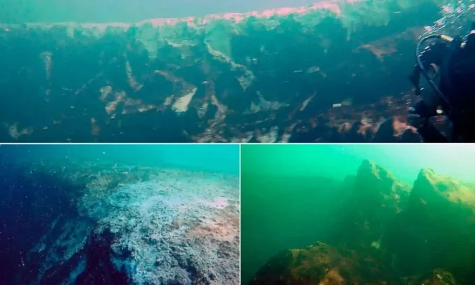
From above, a blue hole can look like someone has cut a dark circle into a pale sea. Its color hints at depth, but the story often began on land or beneath a much lower sea level. How blue holes form connects limestone, rainwater, caves, and the ocean's slow return.
Water can hollow a landscape from within
Water can dissolve limestone along cracks and enlarge underground spaces. Over time, this creates caves and passages within a karst landscape. Rock structure, water chemistry, and groundwater routes influence the result, so a neat circle at the surface may hide an irregular and complex shape below.
Limestone is not simply melted by ordinary rain. Chemical reactions allow material to dissolve and be carried away over time.
Cracks provide starting routes, but water does not carve every site into the same neat circle. The familiar aerial shape can conceal irregular walls, ledges, passages, and a much more complicated structure below.
Lower seas exposed ground that is now submerged
Some caves formed when sea level was lower and land now underwater had different exposure to air and freshwater. Later rising seas flooded parts of that terrain. Local geology determines the history, so the same age or sequence should not be assigned to every blue hole.
This makes a blue hole a record of changing boundaries. The same rock can pass through very different relationships with air, freshwater, and seawater.
Not every feature has an identical origin or age. A local explanation needs geological evidence, rather than assigning one global timeline to every dark circle visible in tropical coastal water.
Related Stories
Dark blue is an optical clue, not a depth meter
Dark water can reflect depth, light absorption, and contrast with a pale shallow bottom. It is not an exact depth reading. Clarity, shadows, sediment, weather, and image processing also matter, so photographs cannot reliably rank blue holes by how deep or dangerous they may be.
A pale shallow bank may reflect much more light than deep water beside it. The boundary makes the hole's outline stand out.
Deep water can develop distinct chemical layers
Limited mixing can allow distinct water layers to develop in some blue holes. Oxygen, salt, temperature, and other chemistry may differ with depth. Those patterns shape habitats and research questions, but each site needs measurements; a calm surface cannot reveal all the conditions hidden beneath it.
These differences are part of the scientific interest. A blue hole can act as a small, complex system where researchers study how water movement and chemistry shape the organisms able to live there.
Exploration replaces a simple circle with a detailed map
Surveys use instruments, images, and samples to map blue holes. A newly reached depth may revise an old estimate without proving that the deepest bottom was found. Reports should state the method, reference level, and survey limits before readers compare a claimed record with another site.
This distinction matters when headlines announce a new record. The method, date, reference level, and limits of the survey belong beside the number.
The water above a cave can also hide the route by which it connects to the wider sea. A narrow opening may lead into a much broader space. Good maps distinguish the open shaft from any side passages found during a survey.
Limestone caves can become underwater sinkholes after sea level rise, while oxygen layers add a separate chemical history to some sites.
Frequently Asked Questions
The common questions concern color, origin, and depth records. These answers explain the geological pattern without assuming that every blue hole formed in the same way. A account identifies the site and survey method, when comparing measurements made at dates or in underwater systems with hidden passages and uncertain limits.
Are blue holes usually volcanic craters?
Many well-known examples are linked to limestone dissolution and cave development, rather than volcanism. A site's actual geology should be checked before assigning an origin.
Can the darkest hole be called the deepest?
No. Appearance depends on more than depth. Reliable comparisons need measurements made with appropriate methods and clearly stated reference levels.
Does reaching a depth prove the bottom was found?
Not necessarily. An instrument may reach its limit or encounter a passage geometry it cannot follow. Survey reports should distinguish measured depth from a confirmed deepest point.